For many thousands of years this area was inhabited
and caretaken by the local First Nations bands in
a sustainable and respectfull manner. They lived off
the abundance of the salmon, wildlife and natural
food sources. The tribes eventually colasced into
one tribe after contact with european explorers. They
were decimated by diseases brought by the european
expolorers like small pox. Also, the influence of
guns, alcohol and religion on these insulative communities
was devastating. The local tribes began infighting
and finally colasced into a small remaining tribe
called the Nahwitti. There is no local population
of First Nations any longer at Cape Scott.
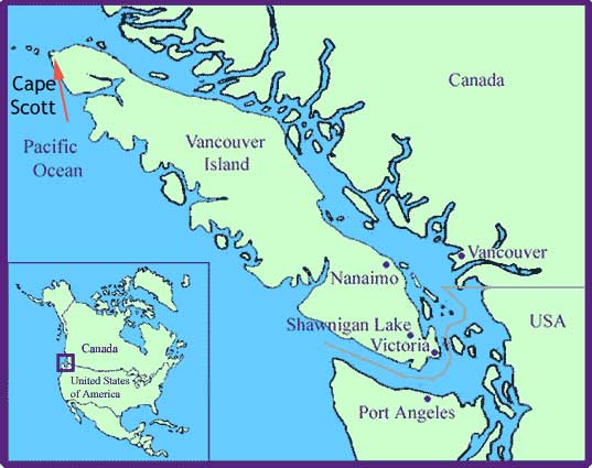
The area was named for the Patron of Captain James
Strange's voyage, Mr. David Scott. Strange was exploring
for the country of England in 1786 and claimed all
that he had navigated for his Queen and Country. His
influence is represented in the many names given to
major features and bays in the Cape Scott Area. This
area was also known for its abundance of Sea Otter.
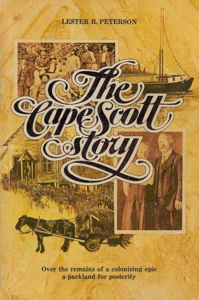
Almost all the facts and references I am making in
this website have been taken from the definitive work
on the area, Lester R. Peterson's "The Cape Scott
Story" published by Mitchell Press in Vancouver
in 1974.
In 1894 a Danish immigrant was fishing
out of Seattle and came ashore at the head of what
would become Hansen Lagoon to take a look around.
Rasmus Hansen decided that this would be a great place
to start a Danish Colony. In the Fall of 1896, the
first group of settlers arrived at Fisherman's Bay,
where the seeds of the colony were planted. By 1899
there was a population of 90 colonists living around
Cape Scott. The government soon gave promises to these
settlers including a road to link them to Holberg
and the rest of the island, a school to teach their
children and eventually, after certain conditions,
ownership of the land. This encourgaged the settlers
to continue to build and this they did with amazing
determiniation. Houses, churches, community halls,
boats, even two dykes! They built their first dyke
in the lagoon to reclaim some estuary land for farming.
However, when celebrating their accomplishment, the
dyke was destroyed by a surge tide and change in wind.
Their determiniation was strong though, as they committed
to rebuild this massive project immediately.
The colony continued to prosper for
the next couple of years and even came to be known
for its "Cape Scott butter". Everything
had to be shipped out by boat and this created tremendous
obstacles for the colonists. Also, when the Provinical
Government changed 3 times in 1899 the upheavel resulted
in a government that retracted all of the previous
governments promises to immigrants and their attempts
to settle areas of the island. Land that was promised
to the settlers after they had devleped and lived
on the land for 5 years was taken away. The road that
was promised was never extended beyond 2 miles out
of Fisherman's bay. Discouraged, many settlers left
and went to Holberg. Many stayed, but the colony was
considered dead after 1907.
Some intersting stories from the settlers:
Everything had to be dropped off by boat and this
created many problems for the settlers. There are
accounts of both a Steam Engine and a Piano beeing
left on the beach for a full cycle of the tides
before enough manpower could be raised to pull it
up. Also, cattle and livestock had to be dropped
off by boat as well, almost all of them would naturally
swim to shore when dropped in the water, however,
none of them would ever swim back out to the boat
to be taken away!
There was incredible stories of how
much weight the settlers would carry as they hiked
the muddy, wet trails. Standard pack weight was
110 pounds. Using one of the old style packs which
could carry everything from stoves to bricks. One
story involves a brother and sister hiking the 4
miles from the store to their house. After arriving
home, the brother asked the sister if she had forgottent
the 50 pound sack of flour from the store, and she
just opened up the door of the stove she was carrying
to show the sack of flour inside!
The government soon opened up the land
for individual speculators. Anyone could make a claim
if they lived on and developed the land they had staked
out. This started a second rush of settlers to the
area. However, the climate, weather, lack of road,
and World War One killed this settlement attempt by
1917. Everyone had to pack out what they could and
leave the rest behind.
After this, there were a few hardy souls
who stuck around seeking out the solitude and isolation
of the Cape. It was not until World War 2 would there
be an influx of of people again. A secret Radar Station
was constructed out at the Cape to help detect for
Japanese war planes. 50 men were stationed here and
they built a road that you walk along towards the
lighthouse that stands even today! There are a few
buildings still somewhat standing from this station.
The final chapter of Cape Scott's history
is in 1971 when the Canadian Forces Station at Holberg
decided to build the current trail out to the Cape
as a Centennial project. It is thanks to these men
that the Park exists for all to use today.
Bibliography
Pearson, R. Lester. The
Cape Scott Story. Vancouver: Mitchell Press,
1974.
|